


was the l.a. fire santa ana wind geoengineered?

As a former resident of Southern California, I knew the reporting by the corporate media that the LA fires were being driven by Santa Ana winds was off by several months, so the first thing I did a few hours after the fire began was go to the National Weather Service (NWS) website to see what was happening. Although the wind was blowing down off the foothills towards the Pacific like a typical Santa Ana, the weather pattern creating that wind was not a Santa Ana pattern. Far from it.
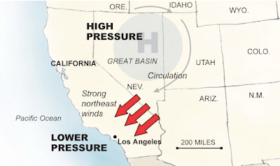
Historically, Santa Ana winds are generated in the fall when high pressure sets up over the great basin of the inter-mountain West - roughly over Nevada. Because High pressure systems rotate clockwise, they can generate a wind around their perimeter that gets thrown off like water from of a spinning wheel. For Southern California, that means a dry wind coming off the desert that becomes even drier due to friction as it tumbles over the foothills and down into the greater SoCal coastal region.
Here’s a graphic of what that weather pattern looks like.
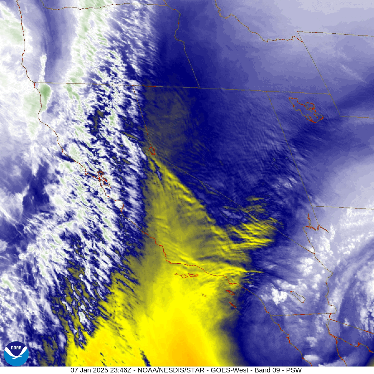
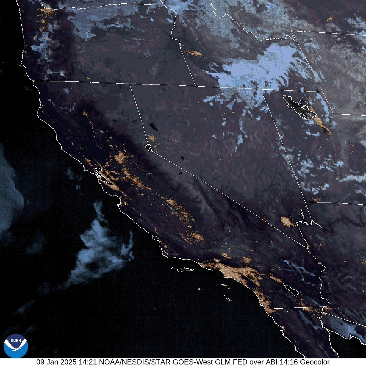
Below is the mid level satellite loop of the Southwestern US from Tuesday evening when the Palisades fire was reported to have jumped from 200 acres to 720 acres. The date and time stamp at the bottom of the loop is Eastern time. I’m three hours behind that.
As you can see, the high pressure that should be roughly over Nevada is not there. Instead there’s a very large high pressure dome over the Eastern Pacific causing a southern flow over Southern California. There is also a poorly organized low pressure system over Southern Arizona that’s moving to the West. At this latitude, lows typically move from the West to the East.
What we need to focus on is a disturbance centered over southern Nevada. If you look closely you can make out a series of concentric ‘cloud’ circles emanating from a central location. Further out from the center are a series of nearly stationary ‘clouds’. The thing seems to have slight counterclockwise spin, possibly caused by the low to its Southeast and the high to the Northwest. Notice how those ‘waves’ slowly migrate out over the Channel Islands.
Folks, that ain’t weather. Those are cymatic wave forms capable of being generated by HAARP and Ionospheric Current Drive (ICD) sytems - both are ionospheric heating systems. They do exactly that, heat up the ionosphere, which causes high pressure to develop beneath the heated region of the ionosphere. It could also be the primary cause of global warming. Of course the UN says nothing about that in its “Climate Report”, nor is anything said about that in the “Paris Climate Accords”.
That artificial cloud pattern, what I’ve been calling cymatic or standing waves, are also known as Mackeral clouds. To cover up what’s really happening, the NWS, which as I’ve reported earlier is run by Raytheon, has come up with an official term for these artificial clouds - “gravity waves”. Right.
The NWS tells us this new, never-before-seen phenomenon is created when high winds compress the atmosphere and generate these weird cloud patterns. More bullshit. As regular readers know, I’ve been watching the weather closely all my life and I never heard the term “gravity wave” until recent years. If you want to know more about how these cymatic waves are created, go here and here.
As I’ve mentioned before, it’s important to keep in mind that NWS personnel have a gag order preventing them from talking about what this really is, as well as other occult weather phenomenon.
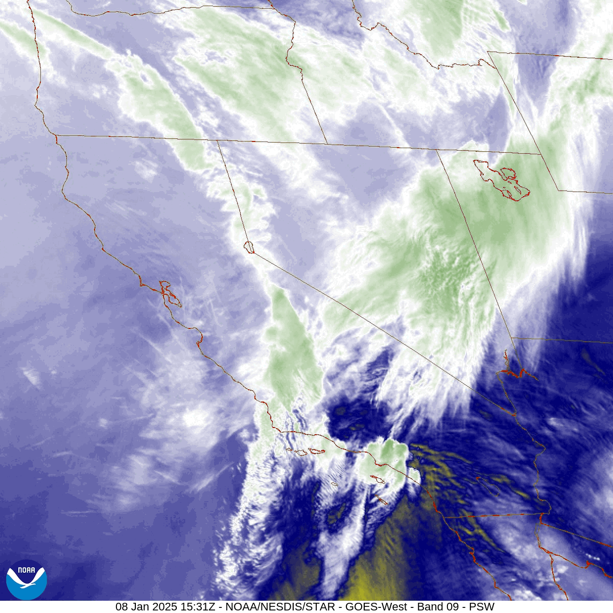
This next loop is the Pacific Coast mid level loop from the morning of the 8th. By now the fire was reported to have burned 1,200 acres. The high over the Eastern Pacific has moved a little further East. The low over Arizona has degraded. The center of the HAARP or ICD induced cymatic ‘storm’ is now conveniently covered up by high cirrus clouds, but we can clearly see cymatic waves being generated over SoCal and out to sea.
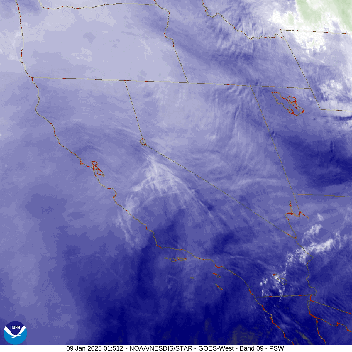
The next loop is from the 9th. The high has become less defined, but we can still see it’s effects. That, combined with the ongoing production of cymatics is still generating a southern flow over SoCal. We can also see that the center of cymatic wave generation now looks to be over Northwestern Nevada, which is helping maintain a southern flow over SoCal.
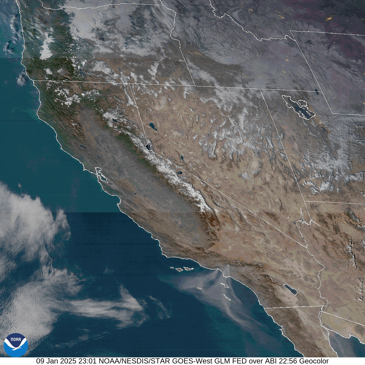
The next loop is the Geocolor satellite loop showing the sun coming up over SoCal. As it does so we can see the smoke plume heading south from LA.
The next one is as the sun sets the same day.
The point here is - high pressure can be generated by HAARP and the cymatic “storm” can be generated by portable ICD systems. Low pressure systems can be steered by both. When properly manipulated, they can create an out-of-season “Santa Ana” wind storm. Combine that with the Directed Energy Weapon (DEW) systems I’ve written about here and you have an LA fire storm of Biblical proportions.
Be free.
thank you for this report. in the radar pix you can easily see the jagged & ribbed patterns in the clouds that the microwave & other electromagnetic frequencies create. :(
I was going to say that these obvious signs of war against your own people in all these supposed wildfires is a form of undeclared civil war. But then I remember that these actors are really working for the Globalist Cabal and their only loyalty is to those who keep them in thrall either through blackmail, or paychecks. The WEF wants to build a new LA with no traffic jams and a showpiece for the 2028 Olympics. You get the land at rock bottom prices, and you "build back better" for you, but not for anybody else. The pointing of fingers at Climate Change from all the MSM tells you who is really behind it. And that smirking Newsom confirms it.