this is not weather - satellite proof of cymatics/chemtrails
My parents enjoyed wild weather. They picked up that trait from my dads parents who lived next door. Grandpa kept track of rainfall with a rain gauge mounted on a post next to a walk that went from their back door to our back door. When big storms hit, one of my parents favorite activities was to get in the car and go for a drive to see the local impacts of the storm. Much of this familial interest in weather stems from the fact that my grandparents and parents (and just about everyone else in my extended family) were farmers. Farmers can never have enough information about the weather.
Growing up in Kansas provided plenty of wild weather to watch. During my teenage years, when big storms began to develop, a favorite activity with my best friend was to watch for tornadoes. When the tornado sirens went off, instead of heading to the basement, we went to the roof. We saw a number of tornadoes, but none ever threatened us.
Growing up in a weather conscious farming family in a state known for having some wild weather turned me into a weather hound. When the National Weather service began a new website decades ago, I quickly became hooked. To this day, part of my daily ritual is to check that site in the morning and again later in the afternoon. After twenty five years of doing this, I’ve become reasonably adept at reading satellite images to determine what weather may or may not be coming. I often catch things that the forecasters at the weather service miss. Part of the reason for that is because the forecasters are slaves to the various modeling computers that use AI to predict what weather will transpire. Sometimes those computers come close to reality, sometimes they completely miss obvious things.
One of the things that some of us who closely monitor the weather have noticed in recent years is that the folks at the National Weather Service (NWS) and the National Oceanographic and Atmospheric Administration (NOAA) are ignoring all of the atmospheric anomalies that have recently been showing up on satellite images. Actually, anomaly is not the right word. Although they are not weather related, we know what they are. They’re part of the globalist geoengineering (chemtrail) projects that are taking place all over the world.
Of course, officially, we are told that geoengineering is still only theoretical. We are told there have only been small, local experiments taking place, tinkering around the edges of “global warming” and weather modification.
What I present below will prove that the official narrative is a pack of lies.
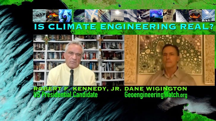
But first I want to once again pay homage to Dane Wigington and his very well researched documentary about geoengineering, The Dimming. If you haven’t yet seen it, please do so. He presents very compelling evidence about chemtrails.
death by aluminum - the toxic aluminum thread that connects vaccines, 5G, dew’s, geoengineering and ‘wildfires’
No creature has ever been found to utilize aluminum. It’s deadly to all life on earth. Oxidized aluminum is 99 to 104 times more prevalent in human blood than any other toxin. The only way we can get that is through inhalation or injection. Dietrich Klinhardt PhD
Although from a different perspective, we’ll be looking at chemtrails in this post. I also want to point out another geoengineering tactic that I don’t recall Dane covering in his documentary - the increasingly blatant and easily documented use of cymatics for weather manipulation.
chemtrails and cymatics from space
I’ve touched on the topic of cymatics in earlier posts, but not in any detail. Cymatics is the creation and study of wave forms (frequencies) generated by sound or other means. The following video provides a great example of how cymatics can influence water, fire, electricity, oil and grains of salt on a platform above a speaker. In particular, the water, oil and salt provide very nice visual interpretations of what the various wave forms look like. Keep those visuals in mind, as I’ll be showing you similar wave forms in the upcoming satellite images from the NWS.
What this video tells us is that cymatics can be used to manipulate water in clouds, enhance fire, enhance electrical conductivity and God only knows what else. Keep all of this in mind as we proceed.
Many of you readers have become adept at identifying chemtrails from your various locations around the world. In his documentary, Dane shows many examples of chemtrails, how they’re created, as well as what’s in them. The official narrative about chemtrails is that they are “contrails”, resulting from exhaust exiting jet airplanes, mostly commercial airliners. Dane presents a lot of undeniable information that disputes that official narrative.
What I want to do is show the existence of chemtrails from another perspective… from the top down. I’ll be using satellite imagery to prove why the official narrative about contrails is a giant load of bullhooey.
Additionally, I’ve recently noticed a big uptick in the amount of cymatics visible in satellite imagery. Most of the satellite images and loops that follow show both chemtrails and cymatic activity.
All of the following images and loops are mid level moisture images from the GOES 18 satellite operated by NOAA. I use the mid-level moisture imagery because most chemtrails are dispersed at that elevation and because cymatic wave forms also show up clearly in that type of imagery. This is also the imagery that NWS personnel most often refer to when discussing forecasts, which is why it’s so strange that they never mention what I’m about to point out.
The first loop below is from the Southern Rockies satellite view from May 23 (see the time and date stamp at the bottom of the images). It shows a streak of high, thin cirrus clouds coming in from the West Southwest, off the Pacific, over the northern Baja California peninsula, the northern Gulf of California and over my neck of the woods of Southern Arizona. What’s absolutely abnormal about this streak are the thin lines of ‘clouds’ that run perpendicular to the natural streak coming in. While the cirrus streak itself began far out in the Pacific, those perpendicular lines don’t appear until they are over the eastern shore of the Baja California peninsula. That’s because they’re man made chemtrails. As this type of geoengineering is apparently designed to do, the chemtrails then begin to spread out and mingle with the natural cirrus clouds as they all move to the east northeast. As this phenomenon approached my region I was able to go outside and verify that those perpendicular lines were in fact identical to the thousands of other chemtrails I’ve seen over recent decades.
Obviously, airlines do not fly numerous short little flights in perfect conjunction with an incoming cirrus cloud pattern. If those were “contrails” created by airline traffic, why do we not see them along the frequently traveled paths of commercial airlines between major cites like Phoenix and LA? Why are the “contrails” so short and why do they zigzag back and forth across the leading edge of an incoming cirrus cloud bank?
side bar
I should add here that this is the most chemtrail activity I’ve seen in this region since Mexico announced a ban on solar geoengineering on January 13, 2023. There must have been some negotiating to allow this new uptick in chemtrail releases to take place. Perhaps it was decided that these chemtrails do not constitute ‘solar geoegineering’.
Mexico’s ban came about after a small US based start-up geoengineering company called Making Sunsets released two weather balloons containing sulfur dioxide over Baja California. They did not have permission from anyone to do so. A few months later the desert region of Sonora Mexico, downwind and across the Gulf of California from where the balloons were released, was hit with record rains and flooding. Sonora suffered billions in property damage and a number of people drowned. This took place just a few hundred miles to the south of where I live.
The other thing to look for in this loop is the cymatic activity over the Eastern portions of Arizona, but mostly over the Western portions of New Mexico, extending up into Southeastern Colorado, down into far West Texas and well down into the state of Chihuahua, Mexico. This is the ripple pattern that, unlike the real weather passing by, does not move. The ripple pattern stays mostly stationary. Real weather is not stationary. It’s constantly being driven along by jet streams. This abnormal pattern will become more apparent in other loops. Keep this cymatic wave form pattern in mind. It will shift a bit to the east and play a big role in West Texas weather in a few more days (upcoming loops).
The following video is the Southern Plains on the 27th of May. I’ve included it because it shows a central point of cymatic activity. If you look closely at the panhandle region of Texas you can see a circular pattern of cymatics that seems to be centered on the southwestern corner of Oklahoma where the Red River ceases to be the boundary between Oklahoma and Texas. From that point you can see cymatic ripples heading out in all directions, but especially to the West, Northwest and Southwest. This is not weather. There is no low or high pressure system, or any other natural weather phenomenon happening to cause this.
Note that the natural weather pattern, the passage of the frontal boundary in Oklahoma and Kansas, is moving to the East while the artificially made cymatic ripples appear to be moving to the West. The central focal point is not moving.
Folks, this ain’t normal.
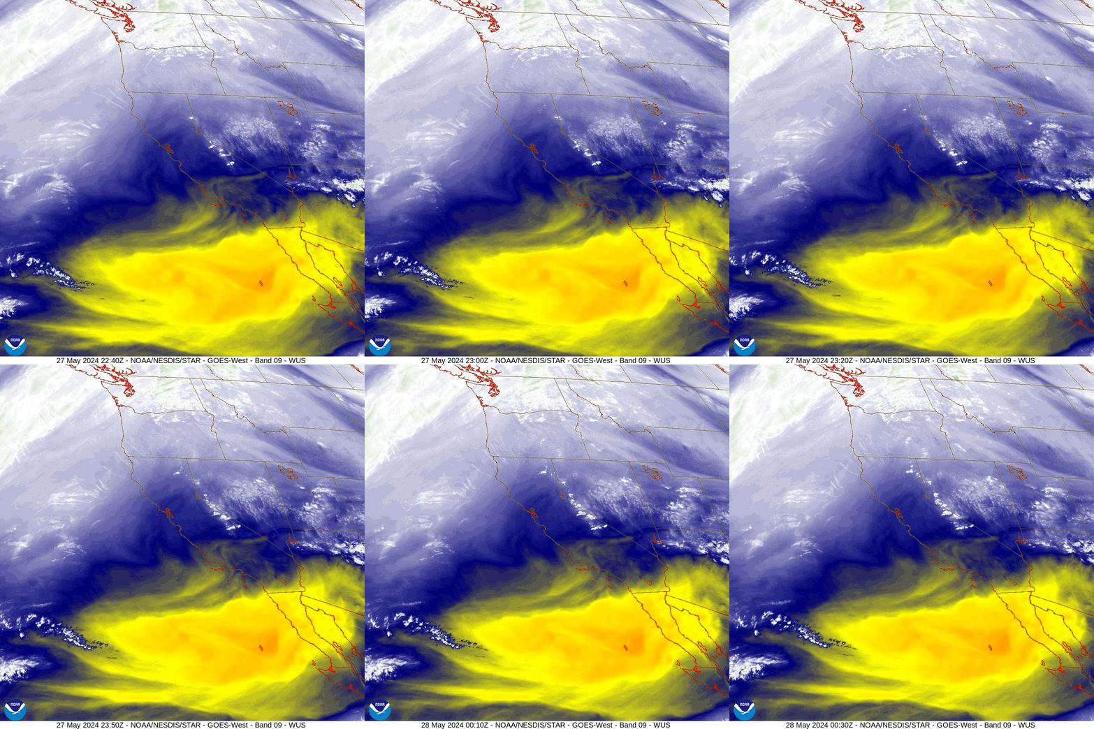
The following loop is the US West Coast. Note the lined up chemtrails marching into southwestern Oregon in a very organized formation. Again, they’re perpendicular to the prevailing cloud pattern. We also see no ‘contrails’ where we would expect to see them - between Seattle, Portland, San Francisco and LA.
The strange cloud pattern in central Nevada is also out of place. It’s reminiscent of the unusual cloud pattern that could be seen just east of Maui in the days before the fires.
The line of clouds forming along the California/Nevada border is typical of upwelling that occurs when moisture laden wind is forced upward by the Sierra Nevada, causing condensation - cloud formation - to occur at higher elevations. This orographic lifting happens in most mountainous regions, including where I live. We’ll see a similar result being accomplished by cymatics in West Texas.
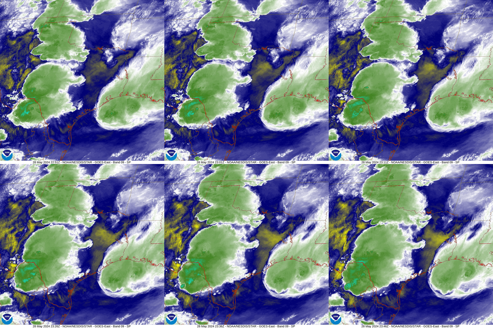
The next one is wild. This is May 28, the day big storms hit Texas.
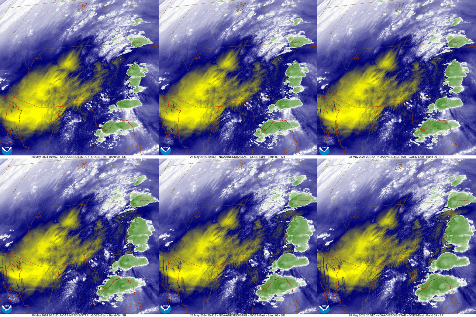
First we see a bunch of squirrely chemtrails appearing down in the lower left hand region. Once again, some don’t appear until the Eastern shore of the Baja CA Peninsula, or even further east. I didn’t save the coastal loop, but it shows no chemtrails to the west of the central mountain range of Baja CA. Most appear just before they come into view of this satellite image.
More importantly, notice the strong cumulus cloud build up along the NM/TX border. Also notice the strong cymatic waves that now pervade eastern NM and extend down into West Texas and Chijuajua Mexico.
The other thing to note are the waves passing to the west beneath the storm clouds. They’re most easily seen in the lower right hand portion of the loop, but they extend almost up to the OK panhandle. This wave pattern could be explained as an outflow from the big storms that hit Dallas earlier in the day.
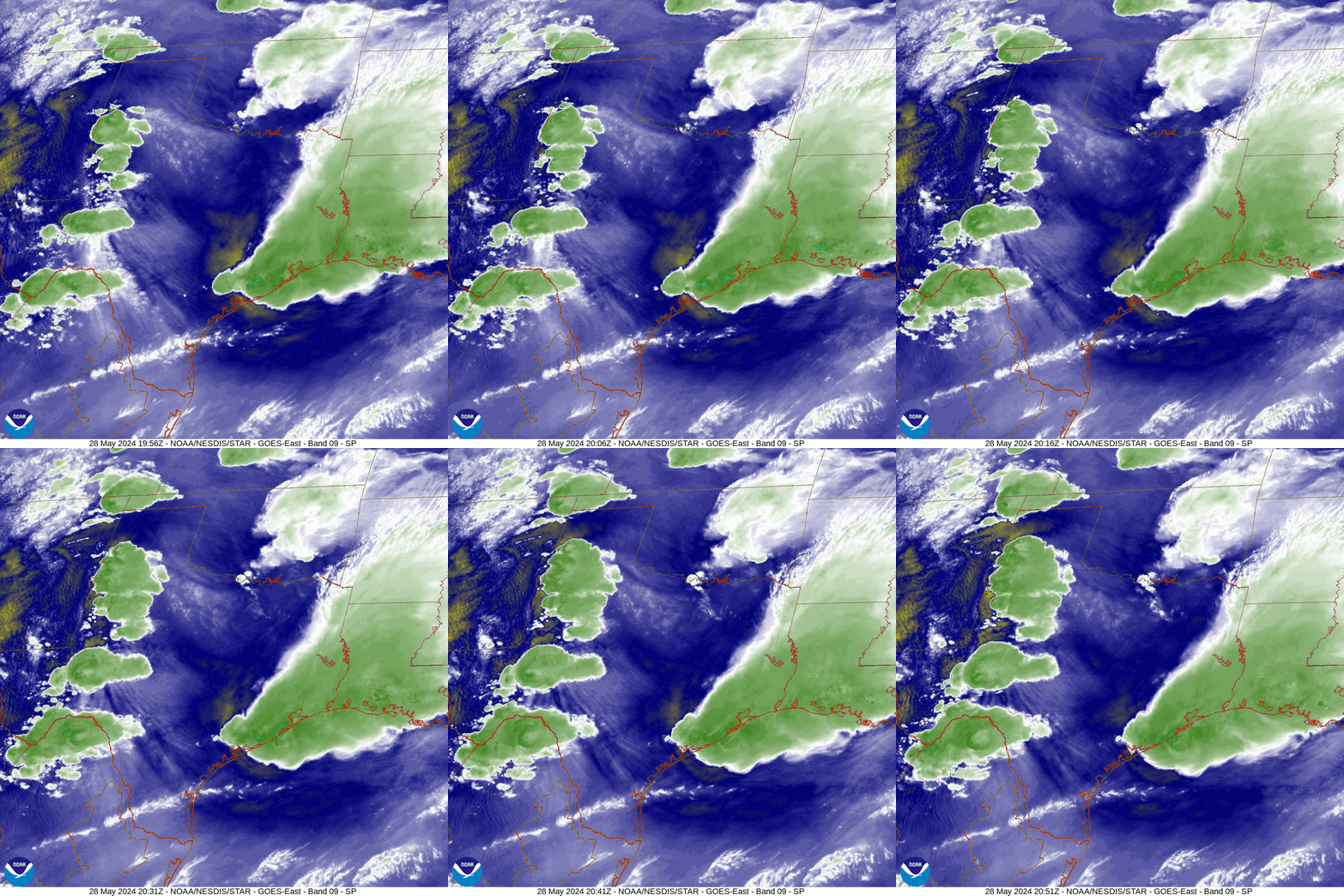
For those unfamiliar, an outflow is what happens when a big storm dumps a lot of rain in a hard and fast downpour. That downpour creates a down draft of colder air that’s pulled down from the upper atmosphere by rain and hail falling from the clouds. When that downdraft hits the ground it splays out across the landscape as wind. This wind can have a clearing effect that shows up on satellite imagery. This is more easily seen in the loop after the next one.
I think we’re mostly seeing an outflow here, although it may have been enhanced by cymatics. When this outflow encounters the cymatic waves in eastern NM and West Texas, the moisture is forced upwards in the same way that mountains do. The result is “orographic lifting” without any mountainous topography. Voilà! Big storms are generated along the NM/TX border.
A characteristic of this artificial type of storm is that the cloud tops go so high so fast that very large hail is often formed. That was the case with these Texas storms.
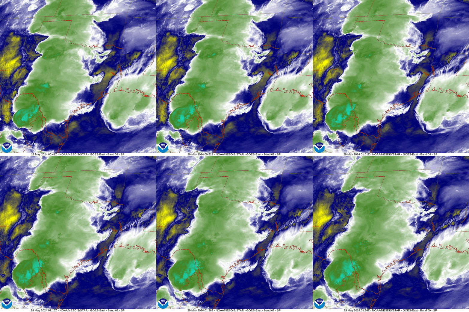
Below we can see the outflow from the big storms that hit Dallas early in the morning of the 28th. The Dallas storms have since moved down to the coast. The line of storms along the NM border is beginning to move east but the cymatic pattern in NM is not moving. The clouds within it are moving but the waves are not.
The following loop is from about 3 hours after the previous one. We can see how the storms in West Texas have evolved and how they are now generating their own outflows. The northern group is beginning to wane while the ones in Coahuila, Mexico are still developing into strong storms. The cymatic waves in NM and West Texas remain.
Below we see that the same pattern was repeated on the 29th. This is later in the day so the storms have already begun to move to the east.
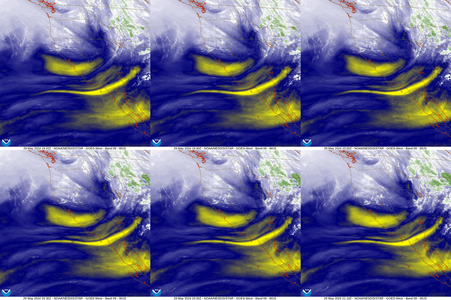
Also on the 29th we see a two large barrages of chemtrails being emitted over Northern California/Southern Oregon and out in the Pacific off the coast of Oregon. Over the years I’ve never seen any area get inundated with chemtrails as much as the Pacific Northwest.
We can also see some cymatic activity over Northeastern Nevada and Northwestern Utah. Note how the natural cloud patterns are moving generally to the east while the cymatic waves remain stationary.
We can also see a bit of “orographic lifting” occurring along the border of Nevada and Utah where the cymatic waves are.
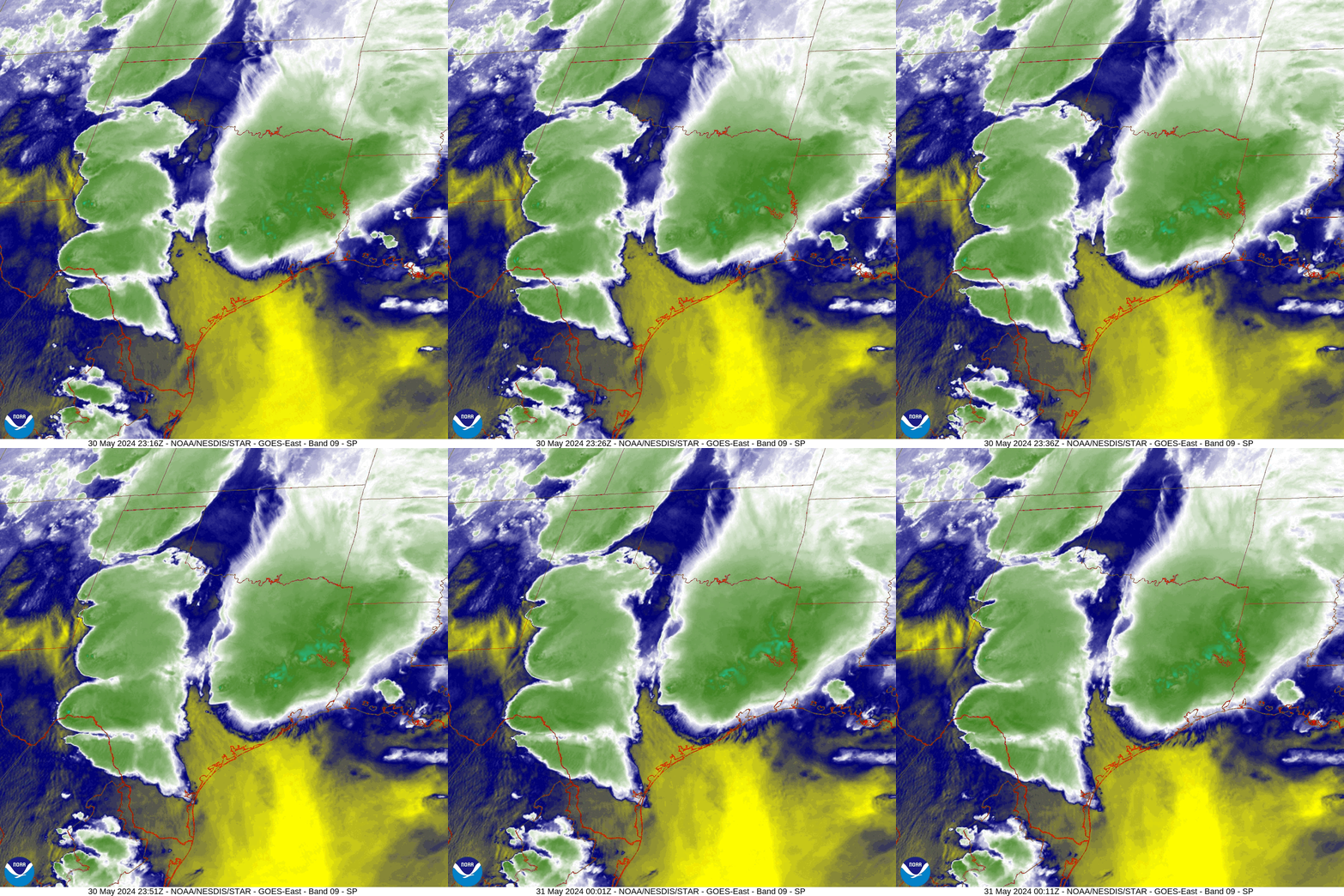
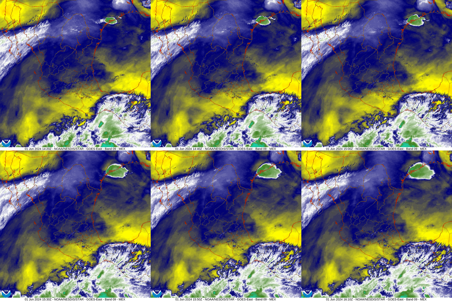
The pattern gets repeated once more on May 30th into the 31st. As these storms wane the cymatics move south into Mexico and the pattern in the US ends. By late on May 31 the cymatics become almost nonexistent in Mexico.
As of June 1 (this morning), there is no trace of the cymatic pattern of the previous weeks, but new cymatic waves can be seen coming up from the southeast over the Gulf of Mexico, indicating that the cymatic geoengineering focus may be shifting to the upcoming tropical flow from the south known in Mexico and the Southwest US as the monsoon.
If I were to try and scry one possible upcoming scenario from the manipulative patterns of the past nine months, it would be that I’m seeing signs for potential fires in the South West US. Pray that I’m wrong.
how and what?
So what is creating these cymatic waves? Honestly, I don’t know for sure and I don’t know anyone who claims to know for sure. I can only speculate based on what is known so far. Right now it appears that the new HAARP technology known as Ionospheric Current Drive (ICD), which I wrote about in the following post, may be capable of producing these cymatic waves.
is this the ultimate globalist weapon?
Let’s review the Hegelian Dialect. The Hegelian Dialect is the ability to create a problem, generate a reaction, (typically fear) so that people will accept the predetermined, profitable, solution. Problem, reaction, solution. The solutions almost always involve t…
By the way, a reader told me the HAARP dome, shown above, was sent into the Gulf of Mexico from Brownsville, Texas (where it was constructed by Halliburton) just a few months before Hurricane Katrina hit the Gulf Coast.
The new ICD HAARP facilities are capable of a dark technology known as chirping. I’m still learning about chirping but it involves the pulsing of extra low frequencies (ELF’s) in tandem with Super Small Size Field Aligned Scattering Mirrors (SSS FAS). We are told the effect achieves the same type of ionospheric heating that the old school, ground based HAARP facilities were able to achieve, except that these ICD facilities are much, much smaller… to the point of being portable. Even the huge one shown above is likely outdated by now. My guess is that they are now small enough to fit on the back of a truck or a medium sized boat.
From what I’m piecing together it appears that this dark chirping tech may be what’s producing these cymatic waves.
I didn’t give my consent to any of this. Did you?
Be free.





I've been watching chem trails for decades now. NO, they didn't exist when I was a kid, 50+ years ago. Yes, I remember what real clouds look like-- I still see them sometimes, but mixed with what I call Sky Shite. I live close to Seattle, I see chem trails virtually EVERY DAY. I hate them. I will happily sign up to stop this in any way I can. Give me a couple of weeks or so to finish getting evicted... ;)
Oh, I almost forgot... I WAS a big fan of Arthur Firstenberg, but he called me a "Jerk" for -- believing in chem trails. He said I didn't understand what's going on. He wrote an article or two about this, but I was too pissed off to read 'em, lol. I don't think I'm wrong, but people never do think they're wrong, do they! ^_^ This from the seriously ANTI EMF guy. He was quite friendly until I mentioned I was enjoying a chem-trail-free day... Is this NOT chemical shit/heavy metals sprayed out of airplanes and then manipulated by HAARP to create our weather? I learned what I learned about this from Dane Wigington. Well, whatever. I just want it to STOP. I hate it, chemicals all over the sky... It CAN'T be good. I'm not great on the details of all this, but I DO understand the generalities, do I not?
today I read a comment about pink oxide high in the Sierra's, Last summer while hiking in the Rockies we came across pink algae, a photo on my stack Nature and the wilderness.. Now I wonder if we were actually seeing oxide?? Great comprehensive article. I followed Dutchsinse for a long while who from what I remember is pointing to the same tech that you are. Are you saying that it is not so much chem trails causing the storm fronts to form, but cymatics? I call them airplane dingleberries, certainly cause the sky to fill with a quilt batting of silvery clouds, which leads to rain the next day. Are you saying that the frequencies are what cause the chumtrails to disperse? I seriously watch the planes fly over, I live 15 minutes from the FED EX hub. planes over head all the time it seems, and I see the criss cross of the trails on some days, and I know about an hour later the blue sky will have a silver batting transparent but the sky is no longer blue.